Surveying and Geomatics Engineering
Under the surveying and geomatics engineering consulting subsector, we offer a comprehensive suite of services, including but not limited to;
- Bathymetric surveying,
- Hydrographic surveying,
- Hydroacoustic surveying,
- Cadastral and land surveying,
- Marine surveying,
- Topographical and engineering surveying,
- Hydrological and meteorological surveying,
- Surveying tools and equipment.
Our surveyors and geomatics engineers possess technical expertise and knowledge to offer a comprehensive suite of survey and mapping solutions, using innovative modern technologies. We deploy leading survey technologies as RTK, LiDAR, and Drone UAV solutions, which simplify the collection and analysis of geospatial data. We leverage advanced technologies and time-tested methods to collect, analyze, and interpret survey data for unparalleled accuracy, completeness, and reliability. From concept to delivery and every stage in between, we provide our clients with reliable, efficient, and cost-effective survey solutions. We have extensive deep domain expertise, operational flexibility, and technical resources to ensure your project’s success.
Bathymetric Surveying
Bathymetric Surveying
Bathymetric surveying is the measurement of depth of water bodies, used for purposes as;
- Pre dredge and dredge monitoring,
- Navigation,
- Pipe laying,
- Mapping sediment thickness,
- Channel design,
- Calculating desilting quantity,
- Monitoring of shoreline changes,
- Numerical analysis studies during techno-economic feasibility studies for marine structures as jetties, breakwaters structures, seawalls,
- Port planning and expansion,
- Depth of bed determination,
- Shoreline determination,
- Navigation chart preparation,
- Locating of mean sea level,
- Identification of scouring, silting, and bed irregularities,
- Tide measurement,
- River and stream discharge measurement,
- Planning of massive structures as bridges, harbours, and dams,
- Seabed mapping.
Through high-precision bathymetric surveys, we amass data in all water environments, using techniques that provide highly detailed models for shoreline erosion monitoring, mapping of deposits on seabeds, rocky outcrops identification, volume calculations, and for dredging and underwater construction monitoring and surveillance work, and much more.
Hydrographic Surveying
Hydrographic Surveying
Hydrography is the science that deals with all measurements and descriptions of the physical features of bodies of water and their littoral land areas. A hydrographic survey is defined as the process of gathering information about the physical characteristics of water areas, such as water depths, navigation channels, and structures, to create nautical charts used by mariners. It is essential for offshore exploration, construction, and maintenance activities related to water bodies. Hydrographic surveys support a variety of activities such as;
- Port and harbour maintenance,
- Desilting and dredging activities of lakes and channel bottoms,
- Coastal engineering (beach erosion and replenishment studies),
- Coastal zone management,
- Offshore resource development.
We offer hydrographic surveying services, generally aimed at planning and development of landing sites and docking bays, establishing depth of water sources, and presence or absence of any submerged obstacles. A major purpose of hydrographic surveying is to obtain data necessary for preparing nautical charts, which show water depths, navigation channels, structures (such as piers), breakwaters, and so on and which are used by mariners.
In broad terms hydrographic surveys would include all underwater surveys encompassing all navigational, pipeline routing, and sub marine cable installation and dredging surveys. Our experts use the latest advanced technologies to offer hydrographic surveying services for projects in sediment mapping, pipeline inspection, post dredge surveying, and development of jetties. Hydrographic surveys capture seabed topographic and other spatial features i.e. coral reefs, underwater mountains, which assists in maritime navigation, marine construction, dredging, offshore oil exploration/offshore oil drilling and other related activities. A hydrographic survey can take place in a river, lake, port, seaway or the ocean itself.
River Surveys.
A river survey is a type of hydrographic survey that involves measuring and mapping the physical features of a river and its surroundings, including its channel, banks, and adjacent land. River surveys are typically carried out by hydrographic surveyors using specialised equipment, such as boat-mounted echo sounders, global navigation satellite systems (GNSS), and total stations.
The purpose of river surveys is to gather information about the physical characteristics of a river, such as its width, depth, flow rate, and bed profile, as well as its surrounding land, including vegetation, structures, and topographical features. This information is used for a variety of purposes, including;
- Flood risk management: River surveys provide critical data about a river’s hydrological characteristics, which can be used to predict and manage the risk of flooding,
- Water resource management: River surveys can be used to gather data about water flow rates, which can be used to manage and allocate water resources, such as for irrigation and drinking water supply,
- Navigation and dredging: River surveys can be used to determine the depth and width of a river channel, which can be used to plan and improve navigation and dredging activities,
- Environmental management: River surveys can be used to gather data about the physical characteristics of a river and its surrounding land, which can be used to support environmental management and conservation efforts,
- Hydroelectric power generation: River surveys can be used to gather data about the flow rate and topography of a river, which can be used to design and optimize hydroelectric power generation systems.
River surveys typically include the following elements:
Hydrographic surveys: Surveys of the depth and bed profile of a river, which can be used to produce bathymetric charts and cross-sectional views of the river channel.
Topographical surveys: Surveys of the surrounding land, including vegetation, structures, and topographical features, which can be used to produce topographical maps and models of the river and its surroundings.
Hydroacoustic Surveying
Hydroacoustic Surveying
Hydroacoustic surveying is generally undertaken on water bodies as fresh water lakes for purposes of fish stock assessment. Hydroacoustics or echo-sounding is a non-destructive way of sampling fish in lakes and reservoirs using the application of sound in water. Hydroacoustics can rapidly survey extensive lengths of rivers or lakes, enabling stock assessment of fish at the community level. Hydroacoustics enable us to gather information on fish presence and absence, their numbers, the depth they are at and their sizes. The surveys are conducted at night, since fish are more evenly distributed throughout the water column during hours of darkness, therefore more easily surveyed when compared to daytime surveys.
We undertake hydroacoustic surveys, enabling the determination and explaining quantities and distribution of various fish groups in a water body of interest. We survey many waterbodies from shallow lakes to large tidal rivers. We can undertake full surveys, post processing of data and analysis, as well as GIS mapping of fish density distribution data and production of final reports.
Within the last decade hydroacoustic fish surveying has developed into a quantitative and cost-effective method of surveying fish populations in lowland rivers and lakes. Hydroacoustic methods utilize sound waves to detect marine organisms. Modern echosounders can not only be used to determine stock parameters but also allow identification of habitat use, species composition and further parameters of marine ecosystems.
We provide high accuracy fish stock assessment studies, fishery resource assessments, fishery behaviour surveys especially for migratory fish, fishery independent surveys, utilizing high level hydroacoustic surveying equipment and echograms generated by the echo-sounders.
Cadastral and Land Surveying
Cadastral and Land Surveying
Land surveying is a technique for acquiring comprehensive information on the topography of the land for use in future planning, designing, and setting property boundaries. Our cadastral surveying package includes services such as general land administration, land titling, boundary opening, area verification (acreage), land subdivision, transfer of titles, title processing, GIS mapping, and real estate development. Our land surveyors and GIS experts leverage advanced technologies and time-tested methods, including GIS and remote sensing technologies to collect, analyze, and interpret survey data for unparalleled accuracy, completeness, and reliability.
Categories of land surveys and their purposes.
Boundary Survey.
A boundary survey (boundary opening) establishes the boundaries of the property mentioned in the deed document. It depicts the start and end of the property. A boundary survey will be sufficient if you only require basic information about your property. For every sort of property, whether it is commercial or residential, boundary studies are crucial. This kind of survey is typically used to resolve neighbour property disputes or when selling or purchasing real estate.
Topographic Survey.
The terrain’s geographic features are a topographic survey’s primary focus. All information on elevation points, contour lines, slopes, etc., are being collected here. The aim is to compile all information regarding the lands’ natural and anthropogenic aspects.
Construction Survey.
Construction surveys are essential whether the project is for a building, bridge, road, or highway. This will identify all significant land surface features that can affect the building. During the surveying procedure, the surveyor will determine the spots on the property that can be used as markers to direct the construction of the new structure. This study lays out the utility lines, substantial construction sites, street networks, their locations, and the alignment of highways, roadways, and bridges. Construction surveys are crucial for every project since they directly impact the budget, schedule, design elements, and other factors.
Subdivision Survey.
A subdivision survey is performed when land is divided into two or more lots, either for immediate or future building development or sale. It is also widely applied in the sharing of land amongst beneficiaries or siblings, especially at property inheritance.
Marine Surveying
Marine Surveying
Marine surveying includes inspections, surveys or examinations of marine vessels to assess, monitor, and report on their condition and the products on them, as well as inspections of damage caused to both vessels and cargo. A marine survey is essential for determining what repairs or upgrades are required so a vessel might operate under safe conditions at sea. Marine surveys ensure that all systems onboard vessels run smoothly, so there are no accidents, or loss of life and property at sea. They also help to know the actual value of a boat or vessel.
Our marine surveyors evaluate, inspect, and appraise a variety of marine vessels and watercraft such as ships, yachts, boats, dredges, and tankers to determine overall condition and ensure quality and safety. They monitor and report the conditions of the equipment, machinery, and products of vessels. They conduct a variety of operating tests and inspect interior conditions. They perform their tasks, prepare reports, and provide recommendations for maintenance and repairs. They conduct surveys throughout the life of marine vessels to make sure they are abiding by the necessary standards at all times.
We undertake different types of marine survey and marine consultancy assignments, including;
- Hull damage,
- Fire and explosion investigations,
- Forensic investigation and specialist survey consultancy,
- Claims and casualty investigation,
- Decommissioning advisory (for abandoned and deteriorating assets),
- Pollution,
- Sinkings,
- Salvage and bunker disputes,
- Collisions,
- Cargo disputes,
- Crew injury,
- Design of seabed surveys,
- Remote monitoring (for abandoned or deteriorating deep water facilities),
- Machinery failure,
- Offshore diving services (to make underwater inspections and surveys),
- Forensic investigations,
- Advisory on loss prevention,
- Marine salvage and wreck removal consultancy.
It is required that marine surveys be conducted throughout the ship’s life (building new ship, annual survey, interim survey, special survey) to ensure standards are maintained. It is also a requirement by domestic statutes and international conventions by the International Maritime Organization (IMO), that regular ship inspections are undertaken.
Our marine surveyors conduct inspections of vessels of all types, including commercial vessels, cargo vessels, passenger vessels, barges, tugboats, warships, ferries and pleasure yachts that are under 20 metres, all the way up to tankers measuring over 200 metres. They also inspect marine cargo and facilities like drydocks, canals, docks and oil rigs for pre-purchase evaluation, insurance claim resolution, regulation compliance and marking insurance eligibility. The different types of surveys undertaken by our marine surveyors include;
- Marine warranty surveys,
- Charter surveys,
- Offshore structural surveys,
- Cargo surveys,
- Hull and equipment surveys,
- Vessel condition surveys (we offer independent and impartial condition surveys),
- Pre-purchase surveys,
- Accident or damage surveys,
- Technical surveys, inspections, and audits.
We offer a wide range of design consultancy services, ensuring optimal costs and operational efficiency. Studies we undertake include;
- Baseline data collection studies,
- Investigations of sea processes and erosion problems,
- Advanced computer modelling of waves, currents, water levels and sediment transport,
- Port planning impact assessments,
- Dredging and dredged material management strategies,
- Sand bypassing investigations,
- Coastline hazard definition studies,
- Vessel manoeuvres in terminal design and tanker offloading operations,
- Estuary and coastal zone management plans.
We possess a unique combination of expertise in specialized marine equipment and surveying with marine science disciplines. Our team of dedicated professionals strives to provide exceptional innovative solutions and latest technology to the marine surveying industry. From concept to delivery and every stage in between, we provide clients with reliable, efficient, and cost-effective survey solutions.
Topographical and Engineering Surveying
Topographical and Engineering Surveying
Topographical surveys/design surveys are used to survey underground and top of land, obtain general details of built environment (i.e. underground and on top), determine the terrain/landscape of area under study, contouring, digital elevation models (DEM), digital surface models (DSM), digital terrain models (DTM), and generation of profiles, all aimed at understanding the general terrain of the area.
Topographical or land survey is a type of land survey that maps and records the physical features of a piece of land, including the contours, vegetation, buildings, bodies of water, and other features. Topographical surveys provide detailed survey data consisting of natural or artificial features and thus allow the client to use the information collected for the design and constructions or implementation stages. Topographical surveys are used for a wide variety of purposes, including land-use planning, infrastructure development, and construction. They can help identify areas that may be problematic for building or development, such as steep slopes, wetland areas, or areas prone to flooding. They can also help identify areas that may be of ecological or environmental significance and provide valuable information for conserving natural resources. The data generated from a topographical survey can be used in the design and planning of construction projects, as well as in the preparation of detailed site plans and maps. These maps and plans can then be used by engineers, architects, and contractors to make informed decisions about the development and construction of new buildings and other structures.
Why undertake topographical surveys.
Land-use planning: A topographical survey provides important information for land-use planning, helping to determine the best use of a piece of land and identify any potential challenges or limitations.
Construction planning: If you are planning to build a new structure on a piece of land, a topographical survey helps you determine the best location and design for the project, taking into account the physical features of the land, such as slope and vegetation.
Infrastructure development: Topographical surveys are also useful for infrastructure development projects, such as the construction of roads, bridges, pipelines, and other structures, as they can provide detailed information about the terrain and other physical features of the land.
Environmental assessments: A topographical survey provides valuable information for environmental assessments, helping to identify areas of ecological or environmental significance and provide data for conserving natural resources.
Flood risk assessments: In areas that are prone to flooding, a topographical survey provides information about the elevation and contours of the land, helping to identify areas at risk of flooding and inform flood risk assessments.
Property boundary disputes: A topographical survey can be used to resolve property boundary disputes, providing an accurate and up-to-date map of the land and its features that can be used to determine the location of property boundaries.
In summary, a topographical survey provides valuable information for a wide range of applications, from land-use planning and construction to environmental assessments and property boundary disputes.
Engineering surveying.
Engineering surveying does apply in planning and development of engineering projects, such as road construction, building construction, etc. It involves earthwork surveys, aimed at guiding subsequent activities such as grading, bush clearing, laying road sub base, and levelling.
In building construction, engineering surveys are key to guide levelling of building foundations, obtaining levels of columns, and guiding the levelling and laying of struts and ties.
Powerline surveying.
Powerline surveys can be topographical surveys, aimed at mapping out pipeline routes during electrification i.e. power transmission and distribution. They include surveying of the powerline corridors, preliminary surveys, boundary opening, and levelling.
Demarcation surveys the setting or marking of boundaries or limits of an area.
As-built surveys verify the dimensions and other spatial perimeters of constructed features are according to the approved designs.
Setting out surveys to stake out reference points and markers that will guide the construction of new structures such as roads or buildings etc.
Drone Surveying and Aerial Mapping.
Drone surveying and aerial mapping are technologies that use unmanned aerial vehicles (UAV), commonly known as drones, to collect data for surveying and mapping purposes. In drone surveying, the drone is equipped with high-precision sensors, cameras, and LiDAR Units, which is used to collect data about the topography, features, and conditions of a specific area. This data can be used to create digital elevation models (DEM), orthomosaic maps, and other types of maps and visualisations that provide a detailed view of the surveyed area. Drone surveying is often faster, more cost-effective, and safer than traditional ground-based surveying methods.
In aerial mapping, the drone is equipped with high-resolution cameras and sensors, and is used to create aerial images and maps of the surveyed area. This data can be used to create topographical maps, 3D models, and other types of visualisations that provide a bird’s eye view of the area. Aerial mapping is often used in a variety of applications, including land management, urban planning, environmental monitoring, and disaster response.
Both drone surveying and aerial mapping have several advantages over traditional ground-based surveying and mapping methods, including increased efficiency and accuracy, improved safety, reduced costs, and the ability to survey areas that are difficult or impossible to access using ground-based methods. They are applied for surveying large swaths of land area, cable fault finding, subsurface scanning, and underground scans.
UAVs are ideal in the following environments or schemes;
- Quarries and landfill sites,
- Earthworks schemes,
- Heritage projects,
- Inspection works such as roofs and facades.
Laser scanning in surveying.
Laser scanning, also known as lidar (Light Detection and Ranging), is a surveying technology that uses laser beams to accurately measure the distance, shape, and position of objects in a given environment. The laser scans the environment and collects data, which is then processed to create a highly accurate 3D model of the environment.
Volumetric analysis (stockpile analysis/stockpile volumetric assessments),
Volumetric analysis is a process used to calculate the volume of an object or space. It is commonly used in a variety of industries, including construction, mining, and geology, to determine the amount of materials or resources in a given area. This can range from individual stockpiles, quarries, and earthwork schemes.
Volumetric analysis can be performed using a variety of methods, including;
Mathematical calculation: The volume of an object or space can be calculated using mathematical formulas, such as the formulas for the volume of common geometric shapes like cylinders, cones, and spheres.
Surveying: The volume of an object or space can be calculated by surveying the area and determining its dimensions, and then using these dimensions to calculate the volume using mathematical formulas.
Laser scanning and 3D modelling: The volume of an object or space can be calculated using laser scanning and 3D modelling technologies, which provide highly accurate and detailed data about the dimensions and geometry of the object or space.
Volumetric analysis is important for a variety of purposes, including determining the amount of materials or resources in a given area, estimating the cost of construction or mining projects, and tracking changes in the volume of an object or space over time.
Measured Building Surveys.
Measured building surveys, also known as architectural surveys, are detailed surveys of the internal and external features of a building, including its layout, dimensions, materials, and finishes.
The purpose of measured building surveys is to produce an accurate and comprehensive record of a building’s existing conditions, which can be used for a variety of purposes, including:
Building maintenance and refurbishment: Measured building surveys are used to assess the condition of a building, identify potential maintenance and refurbishment issues, and plan for future works.
Space planning and design: Measured building surveys provide architects and designers with the data they need to plan and design new spaces within a building, or to reconfigure existing spaces.
Asset management: Measured building surveys are used to maintain a detailed record of a building’s assets, including its floor area, structural components, and fixtures and fittings.
Lease documentation: Measured building surveys are used to produce accurate and comprehensive lease documentation, including floor plans and condition reports.
Measured building surveys typically include the following elements;
Floor plans: Detailed floor plans showing the layout and dimensions of each floor of the building, including the location of internal walls, doors, and windows.
Elevations: Elevations of each façade of the building, showing the height, width, and position of the building in relation to its surroundings.
Cross-sections: Cross-sectional views of the building, showing its vertical structure, including floor heights, ceiling heights, and the location of structural elements.
At the end of a measured building survey, we prepare and submit a comprehensive report that includes detailed information about the building’s structure, dimensions, and features. The contents of the report may vary depending on the scope and purpose of the survey, but typically it will include the following;
Building plans: The report will include detailed plans of the building, showing the layout, dimensions, and features of each room, as well as any architectural elements such as doors, windows, stairs, and walls.
Elevations and sections: The report may also include elevation and section drawings, which show the vertical dimensions of the building and highlight any areas of concern or special features.
3D models: Many measured building surveys include the creation of a 3D model of the building, which can be useful for architectural and engineering design, construction planning, and property management. The 3D model may be included in the report or provided separately in a digital format.
Photographs: The report may include photographs of the building’s interior and exterior, as well as any areas of concern or special features.
Survey report: A survey report may also be provided, outlining the methodology, site conditions, who undertook the survey and any issues that may have occurred on site.
Overall, the report from a measured building survey should provide a comprehensive and detailed picture of the building’s structure and features, and can be used for a variety of purposes including property management, construction planning, and architectural and engineering design.
Earthworks Design.
Before construction, developers often require ground works to create a suitable landform for their project. Sites may contain natural or man-made constraints to development, such as foundations from previous structures, or geotechnically and environmentally unsuitable materials. Reprofiling may also be required to provide suitable construction platforms.
Earthworks design identifies and specifies the required works to address these problems and to provide cost-effective and sustainable solutions that prioritise the maximum, appropriate reuse of site materials.
Hydrological and Meteorological Surveying
Hydrological and Meteorological Surveying
Hydrological surveying, mainly surface water hydrological surveys are undertaken for projects that involve abstraction of water from surface water sources as rivers as well as groundwater. It is aimed at documenting the inflow, route, and outflow of rivers. The objectives of hydrological surveys may include defining flood magnitudes for given return periods. On the other hand, meteorological surveying mainly relates to studies in weather conditions and changes to the earth’s atmosphere.
Our work around hydrology and meteorology studies borders on the installation of weather and hydrological instrumentation, to aid in real time data capture of weather events, and other parameters.
This includes installation of systems and equipment as;
- Automatic weather stations (AWS) i.e. real-time weather stations,
- Compact digital weather sensors,
- Weather radars,
- Dry deposition monitoring stations,
- Hydrometric networks,
- River flood forecasting systems,
- Flash flood alert systems,
- River gauge stations,
- Flood early warning systems (FEWs) and urban flood warning stations,
- Piezometric monitoring wells,
- Meteorological sensors i.e. temperature, humidity, barometric pressure, rainfall, solar radiation,
- Lightning detection radars/sensors (detects and warns of lighting),
- Tipping bucket rain gauges,
- Soil moisture sensors,
- Scintillometers,
- Pyrgeometers,
- Sunshine duration sensors,
- Staff gauges,
- Ground geophones,
- Seismic recorders,
- Piezometers,
- Crack meters,
- Pyranometers,
- Inclinometers,
- Earthquake observatory system,
- Marine grade weather stations,
- Precipitation sensors,
- Crop monitoring sensors,
- Air quality monitoring sensors,
- Wind monitoring sensors,
- Telemetric digital surface and groundwater water monitoring stations.
Data obtained from hydrometric networks is used for;
- Preparation of surface water hydrological assessments,
- Drought monitoring and forecasting,
- Design and optimization of dykes, polders, aqueducts, and flood structures,
- River basin planning and watershed management,
- Water quality and abstraction permit compliance monitoring,
- Stormwater runoff analysis,
- Environmental flow studies (E-flows),
- River basin catchment flood risk assessments/flood studies and comprehensive hydraulic assessments,
- Reservoir flood modelling,
- River dredge studies,
- Preparation of flood plain management plans,
- Preparation of surface water management plans.
Surveying Tools and Equipment.
Surveying Tools and Equipment.
- Underwater remotely operated vehicles (ROV),
- Side scan sonars,
- Single beam echosounders,
- Multibeam echosounders,
- Unmanned aerial vehicles (UAV),
- Unmanned surface vehicles (USV),
- Inertial navigation systems (INS),
- Surveying drones,
- Mobile lidars and UAV lidars,
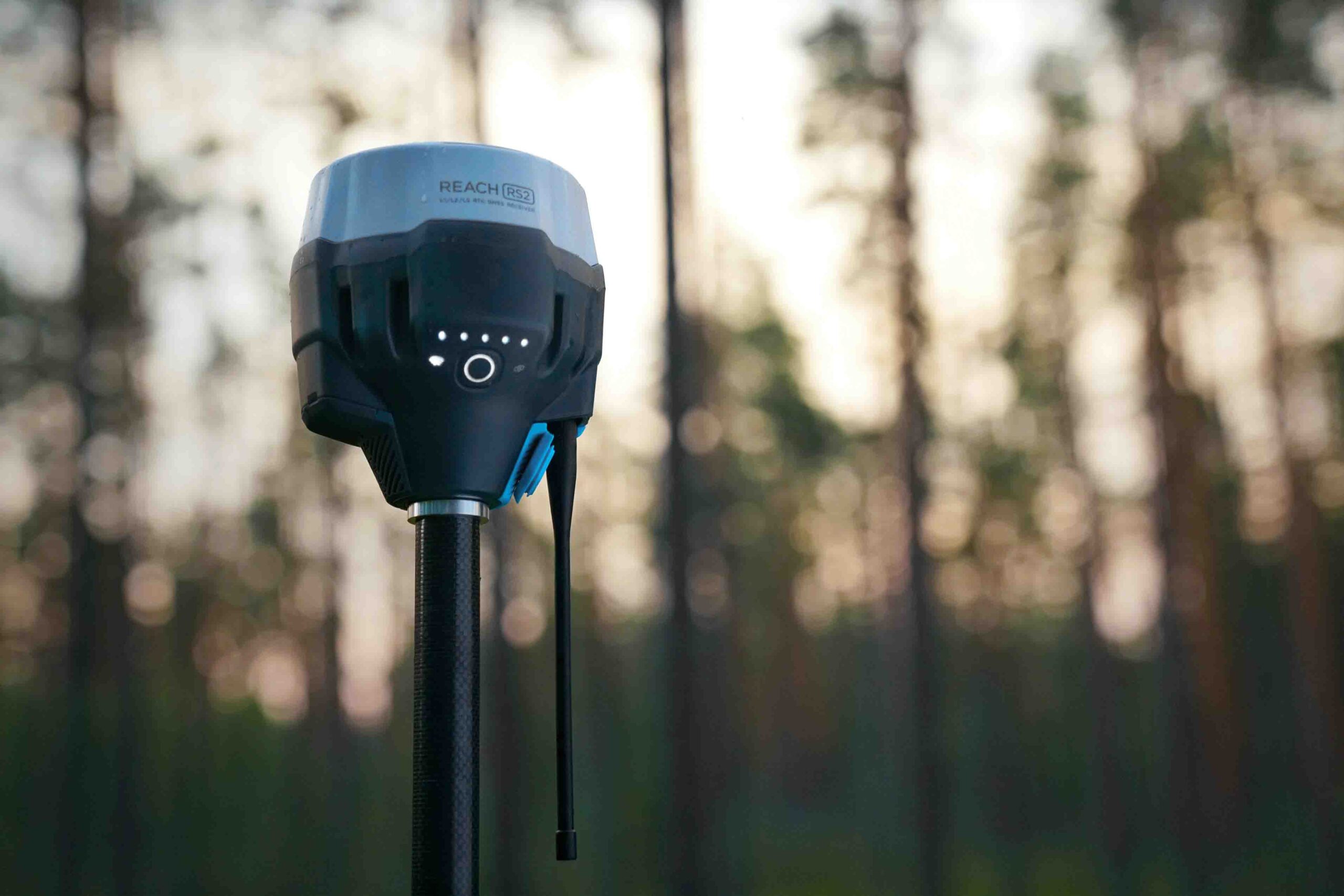
- Real time kinematic survey equipment (RTK),
- Optical total stations,
- Theodolites,
- Dumpy levels,
- Fathometers,
- Differential global positioning systems (GPS handsets),
- Acoustic doppler profiling systems (ADCP),
- Submersible cameras (underwater cameras and lights),
- Unmanned surface vehicles (USV),
- Bathymetric LiDAR sensors,
- Accelerometers,
- Airborne laser scanners,
- UAS lidar systems,
- Handheld laser scanners,
- Laser scanners,
- Portable and indoor mobile mappers,
- Dual grade lasers,
- Global navigation satellite system (GNSS),
- Digital auto levels,
- Survey boats,
- Tilt and vibration sensors,
- Terrestrial laser scanners,
- Tide gauges,
- Sound velocity profilers,
- Sub bottom profilers,
- Relocation strobes,
- Gyro compasses,
- Current meters,
- Underwater cameras,
- Hyperspectral cameras,
- Acoustic cameras,
- Hydrophones,
- Profiling floats,
- Acoustic pingers,
- Autonomous underwater vehicles (AUV),
- Laser distance meters,
- Site lasers,
- Underwater altimeters,
- Depth sensors,
- Robotic total stations,
- Tripods,
- Automatic levels,
- Abney levels,
- Hand levels,
- Turbulence profilers,
- Altimeters,
- GNSS receivers,
- GNSS antennas,
- Lidar sensors,
- Laser rangefinders,
- Mobile mapping systems,
- Digital aerial cameras (aerial mappers),
- Hyperspectral cameras,
- Measuring wheels,
- Compasses and inclinometers,
- Stream gauges,
- Measuring rods,
- Gyroscopes,
- RTK base stations,
- Diver breathing apparatus,
- Diving equipment i.e. underwater torches, diving suits, dive boots and gloves, diving rebreathers, diving fins,
- Oil spill detection systems,
- Wave and surface current monitoring systems,
- Bathymetric survey boats,
- Diver held sonars.