Surveying is the science and art of making all essential measurements to determine the relative position of points or physical and cultural details above, on, or beneath the surface of the earth, and to depict them in a usable form, or to establish the position of points or details. From ensuring accurate property boundaries to supporting construction projects and protecting the environment, the importance of land surveying cannot be overstated. By providing precise and reliable data, land surveys help facilitate informed decision-making, compliance with regulations, and the successful completion of development projects.
Surveying is indispensable in modern infrastructure development, ensuring that projects are built on solid foundations. It remains the invisible backbone of every successful construction project. Before the first excavator moves, before concrete is poured, and before asphalt is laid, surveying works set the stage for accuracy, alignment, and quality. With survey precision as the foundation, the rest of the construction process gains reliability, efficiency, and compliance, the cornerstones of successful project delivery.
Classifications of surveying.
- By method of survey.
- Plane surveying. Assumes the earth is flat (neglects curvature), for small areas.
- Geodetic surveying. Accounts for earth’s curvature, for large areas/high precision.
- By nature of field/terrain.
- Land surveying. Measuring/mapping land surfaces (cadastral, engineering, city).
- Topographic surveying. Maps natural/man-made features and elevations.
- Hydrographic surveying. Surveys bodies of water (rivers, lakes, oceans) for navigation/ports.
- Mine surveying. Maps mineral extraction sites.
- By purpose in civil engineering
- Engineering surveying. For planning/designing projects (roads, buildings, dams).
- Construction (layout) survey. Stakes out design on the ground for building.
- Boundary (cadastral) survey. Establishes/re-establishes property lines.
- Control survey. Establishes precise horizontal/vertical reference points for other surveys.
- Route survey. For long, narrow projects (highways, pipelines, railways).
- As-built survey. Documents location of completed structures.
- By instrument / technique.
- Chain surveying. Linear measurements with a chain/tape.
- Compass surveying. Angular measurements with a magnetic compass.
- Theodolite/tacheometric/total station survey. Precise angular and distance measurements.
- Aerial/photogrammetric survey. Using photographs from aircraft/satellites.
Types of Surveys.
Hydrological surveys.
A hydrological survey is a scientific study assessing water in an area, focusing on quantity, quality, and movement, crucial for sustainable management, locating water sources (like boreholes), or assessing flood risk. It involves collecting data on surface/groundwater, geology, topography, and drainage to understand the water cycle’s components, ensuring responsible resource use and informing infrastructure projects.
Hydrogeological surveys.
A hydrogeological survey or groundwater survey investigates subsurface water, determining aquifer depth, yield, quality (contaminants), and sustainability for drilling boreholes.
Hydrographic surveys.
A hydrographic survey focuses on marine environment and entails the mapping of underwater features like seabed topography, depths, and obstacles for safe navigation, dredging, or coastal restoration. It entails meticulously mapping the underwater landscape, revealing the intricate valleys, ridges, underwater mountains, and slopes that form the seabed. By mapping water depths, seafloor composition, underwater features and submerged hazards, and coastal zones, hydrographic surveys provide the data needed for safe navigation, infrastructure development, and environmental management.
Bathymetric surveys.
A bathymetric survey, sometimes referred to as a fathometric survey, is a type of hydrographic (water-based) survey that maps the depths and shapes of underwater terrain to illustrate the land that lies below. Bathymetry focuses on a single, crucial aspect: water depth across a specific area. Hydrography goes beyond depth measurements, offering a comprehensive view of the underwater environment like a powerful telescope. It incorporates bathymetric data (of course!), but dives deeper by gathering additional information. To conclude, bathymetry tells you how deep the water is, while hydrography reveals everything you need to know about the underwater environment, including its depth. Data collected from bathymetric surveys undertaken for water bodies such as rivers, lakes, and estuaries, can be used to inform flood assessments and project developments.
Geological surveys.
A geological survey is a systematic study of the earth’s subsurface to map features, identify resources (minerals, water, geothermal), assess hazards (earthquakes, landslides), and understand geological structures for construction and environmental planning. These investigations involve field mapping, drilling, geochemical analysis, geophysics (like seismic/electrical), and laboratory testing. Geological surveys form the foundation of successful mineral exploration and mining operations.
Geochemical surveys.
Geochemical surveys involve collecting and analysing samples of soil, rock, sediment, and water to determine their chemical composition. These analyses reveal the presence of specific minerals and trace elements that might indicate nearby ore deposits. Geochemical methods are particularly useful for detecting dispersed mineral occurrences and understanding alteration patterns around deposits.
Archaeological surveys.
An archaeological survey is a systematic and large-scale examination of a designated land area to identify and document any archaeological resources present, such as historic structures, prehistoric artifacts, or buried features. The objective of such surveys is always to preserve cultural heritage by identifying and protecting significant sites that could be disturbed or destroyed in various development or construction projects.
Mine surveys.
Mine surveys are precise measurements and mapping of surface/underground mine workings to ensure safety, optimize resource extraction, plan operations, and maintain accurate records. They involve geometric data collection using tools like total stations, laser scanners, and GPS to map infrastructure, geological features, and assess compliance with engineering designs.
Marine surveys.
Marine surveying is the inspection and assessment of marine vessels, cargo, and structures to ensure safety, seaworthiness, regulatory compliance, and to determine condition/damage, often for insurance, purchase, or repair purposes. Marine surveyors act as independent experts, investigating incidents and providing professional reports.
Land surveys.
Land surveying is the art and science of determining or reestablishing the corners, lines, boundaries, and markers of real property based on recorded documents, historical evidence, and current standards of practice. This process identifies the exact location and layout of a property, its legal boundaries and the condition of any existing structures on the block. It can be of various forms as detailed below:
Cadastral surveys.
A cadastral survey is a type of land survey that defines and records the legal boundaries of a property. It is most commonly used to identify where one parcel of land ends and another begins, ensuring clarity and accuracy for property owners, buyers, developers, and government authorities. A cadastral survey may be required when:
- Buying or selling a property.
- Subdividing a block of land.
- Defining easements or access ways.
- Resolving boundary disputes.
- Registering land with the relevant land titles office.
- Seeking council approval for development.
The word “cadastral” is derived from cadaster. The word cadastre refers to a public record or register of property that includes parcel geometry, ownership, rights, and, in many cases, valuation. These surveys provide public land managers and the public with information essential to correctly determining ownership rights and privileges, and facilitating good land management decisions. A cadastral survey determines or retraces property boundaries (real property) and is closely associated with legal ownership and land registration. In simple terms, it charts and marks who owns what land, not only visually, but legally. Subdivisions, land sales, construction boundaries, and easement layouts all depend on cadastral work.
Subdivision surveys.
Land subdivision survey (commonly referred to as subdivision platting) is the process of splitting a tract of land into smaller parcels. This is mainly used to sell parts of the land or transfer its ownership or to get construction approval for parts of the land. These are also mainly used for land inheritance purposes to divide land among heirs/beneficiaries. Another major area of application is in real estate transactions.
Boundary surveys.
A boundary survey or boundary opening survey focuses specifically on locating and marking the limits of an individual property according to existing legal descriptions and physical evidence. It is typically performed for a private landowner or developer to establish or confirm boundaries for use, sale, or construction.
A cadastral survey, by contrast, encompasses boundary surveying but also involves the legal recording and registration of those boundaries within a broader land administration system. It connects the physical boundary work to ownership records, title documentation, and regulatory frameworks.
In short, all cadastral surveys define boundaries, but not all boundary surveys are part of a cadastre. Cadastral work carries an added legal and administrative dimension, ensuring that boundaries are defensible not only in measurement, but in law.
Boundary opening surveys can be undertaken for various reasons, among them.
- Resolve boundary disputes with neighbors.
- Verify land title accuracy and plot size/shape/location.
- Replace lost corner mark stones.
- Ensure construction (fences, buildings) stays within legal limits and avoids encroachment.
- Identify access roads, easements, rights-of-way, and setbacks.
Engineering surveys.
An engineering survey is the process of measuring and mapping land to guide construction projects. It provides critical data about the land’s surface, boundaries, and structural elements, ensuring that designs are accurate and structures are built in the right location. Without engineering surveys, large-scale projects risk structural failures, costly mistakes, and legal disputes over boundaries. Several types of engineering surveys are used throughout different stages of a large construction project, most commonly the following:
Site analysis and feasibility surveys
Before construction begins, surveyors assess the land to determine whether it is suitable for the proposed project. This includes:
- Examining soil conditions, elevation, and natural drainage.
- Identifying potential obstacles such as underground utilities or protected land.
- Providing data to help planners decide if modifications are needed.
Construction setout surveys.
Also known as setout surveys or construction surveys, these ensure that construction follows the approved design. Surveyors mark out precise locations for foundations, roads, and utility lines to prevent mistakes.
Monitoring surveys.
Once construction is underway, surveyors continue to monitor progress and ensure everything aligns with the original design.
As-built surveys.
As-built surveys document the precise details of a construction project upon its completion, recording any variations from the initial plans. They provide a definitive record for future reference, compliance, and dispute resolution. As-built surveys allow engineers and construction professionals to understand the project’s final specifications.
Structural deformation and settlement surveys.
Over time, buildings and infrastructure can shift due to ground movement or environmental factors. Deformation surveys track any structural changes, allowing engineers to take action before problems escalate.
Deformation surveys.
Deformation surveying helps to establish if a geographical or manmade feature, such as a road, foundation, coastline or river, is changing shape. In deformation surveying, engineers record the three-dimensional coordinates of specific points. After some time has elapsed, they record the coordinates again to see if they have changed. A comparison of the two data sets can reveal if deformation or movement has occurred.
Topographic surveys.
Topographical surveys (topo surveys) detail the elevation and relief of the land, showing contours, grades, and features such as streams, buildings, and trees. These surveys are used in project planning and design phases to understand terrain characteristics fully. Land properties have both natural and artificial features such as trees, buildings, ditches, river sources, fences, etc. This survey helps to locate such features, which are necessary when planning to develop the vacant land. Topographic surveys are fundamental for the successful development of any site and provide developers, architects, and engineers with a detailed, accurate understanding of the land before any construction begins. By gaining an in-depth view of the site early on, developers can reduce future risks and avoid costly mistakes.
Underground utility surveys.
An underground utility survey (underground utility mapping) is a crucial process that identifies and maps hidden infrastructure beneath the ground. It helps locate essential utilities such as electrical cables, water mains, and telecommunication networks. Conducting such a survey before excavation or construction prevents damage to underground services, reduces project delays, avoids legal disputes, and ensures site safety. An underground utility survey is typically conducted before construction, excavation, or redevelopment projects to avoid accidental damage to existing utilities such as water pipes, sewage systems, and telecommunications cables. Without a proper survey, construction projects face significant risks, including financial losses, utility service disruptions, and potential legal consequences. A single miscalculated excavation can lead to widespread power outages or water supply interruptions, causing severe inconvenience and hazards.
Building condition surveys.
A building condition survey is a detailed physical assessment of a property’s current state, identifying defects, maintenance needs, and estimated repair costs for strategic planning, property transactions, or compliance. It covers structures, exteriors, interiors, and mechanical/electrical systems, providing a roadmap for repairs and long-term asset management. It typically delivers a broad overview used for facility maintenance planning, property transactions, or compliance verification.
Structural surveys.
Contrary to building condition survey, a structural survey focuses specifically on the building’s structural integrity and load-bearing elements, examining foundations, beams, columns, and walls to assess potential structural failures, movement, or deterioration. While a building condition survey might note visible structural issues, structural surveys employ specialized testing and analysis to evaluate core structural elements, often requiring destructive testing or specialized equipment to assess hidden components. As such, structural surveys are typically conducted when specific structural problems are suspected or before major renovations that might impact the building’s structural integrity.
Valuation surveys.
Valuation surveying is the professional process of determining the present worth of assets, primarily real estate, land, buildings; for various purposes such as sale, compensation, mortgage, investment, insurance, or legal matters. It involves inspection of properties, analysis of market data, and application of approved valuation techniques to produce a formal report providing expert opinions crucial for financial decisions, ensuring the property’s value aligns with its intended use and market conditions. In engineering, valuation surveying is widely applied during compensation of project affected persons (PAPs). It bridges the gap between physical assets and financial markets, providing objective, expert opinions that underpin major property transactions and financial planning. The opinions of valuation surveyors are sought for purposes such as sale, purchase, secured lending, book purposes, property rates assessment, compensation, insurance, development appraisals, premium and ground rent, and stamp duty. The valuer’s role is to position the land or property in the prevailing market conditions, returning what the market provides under normal circumstances.
Quantity surveys.
Quantity surveying is the systematic process of measuring, estimating, and managing construction costs. It includes calculating the cost of materials, labor and equipment, controlling expenses during construction, and managing cost changes as the construction project evolves. It also covers contract administration, benchmarking construction costs, and preparing lifecycle cost plans that account for the long-term financial impact within the built environment. It is vital for the following reasons.
- Project cost control. Tracks spending against budget and flags potential overruns early.
- Value management. Ensures the building project delivers what was promised, at the expected quality, for the agreed price.
- Construction risk management. Identifies pricing risks in contracts, materials, and changes before they affect the project cost.
Quantity surveyors analyze engineering drawings, site data, and client needs to estimate total project costs. These estimates form the financial foundation and shape decisions on scope, materials, and feasibility. In addition, they do prepare detailed bills of quantities (BOQs), cost estimations, and material schedules prior to construction. During project implementation, they ensure cost control by monitoring and controlling project expenses, identifying savings, and ensuring projects meet budget, quality, and legal standards; thus ensuring value for money for the client.
Importance of Land Surveying
Confirm property boundaries. One of the most important outputs of surveying is verifying the boundaries of the property. A boundary or identification survey ensures that the fences, buildings, and other structures are correctly positioned within the lot; and that the land being sold matches what is shown on the title. This protects you from future disputes or costly rectifications.
Identify encroachments and easements. Surveying helps detect any encroachments, such as sheds, fences, or driveways that cross property lines. It also locates easements and rights of way, which are legal rights allowing others to access or use part of the property (e.g. for drainage, utilities, or access). Knowing about these before you purchase can help you avoid unexpected limitations or legal issues.
Assess development potential. If you are buying a property with the intention to build, renovate or subdivide, a surveyor can advise you on zoning constraints, setback requirements, minimum lot sizes, and other planning regulations. This allows you to make informed decisions based on what is legally permissible on the land.
Dispute resolution and legal protection. A survey conducted prior to settlement can provide legal protection and peace of mind, reducing the risk of disputes or issues after you have taken ownership. In many cases, your solicitor or conveyancer may recommend a current survey to confirm the property’s status and compliance with legal boundaries.
Informed decision making. Land surveys provide detailed information about the land, including its topography, existing structures, and any potential hazards. This information is invaluable for property owners, developers, and architects as it allows them to make informed decisions about land use, construction, and development. For instance, knowing the exact slope of the land can influence the design of a building or the placement of drainage systems.
Compliance with regulations. Land surveying ensures that any development or construction project complies with local and national regulations. Surveyors are familiar with zoning laws, building codes, and other regulatory requirements. By conducting a thorough survey, they can identify any potential issues that need to be addressed to ensure compliance, thereby avoiding costly fines and project delays.
Risk management. Identifying potential risks is another significant benefit of land surveying. Surveys can reveal issues such as flood zones, unstable soil, or other environmental hazards that could impact a project. By identifying these risks early, developers can take appropriate measures to mitigate them, ensuring the safety and stability of the construction.
Enhanced property value. A well-documented land survey can enhance the value of a property. Potential buyers are more likely to invest in a property that has clearly defined boundaries and a detailed survey report. This transparency can make the property more attractive and can potentially increase its market value.
Facilitating land transactions. Land surveys are essential during the buying and selling of property. They provide a clear and accurate description of the land, which is crucial for legal documentation and property deeds. This clarity helps facilitate smooth transactions and ensures that both buyers and sellers have a mutual understanding of the property in question.
Supporting construction projects. For construction projects, land surveys are indispensable. They provide the necessary data for site planning, design, and layout. Surveyors can mark out the exact locations for buildings, roads, and other infrastructure, ensuring that the construction adheres to the planned design. This precision helps avoid costly mistakes and rework.
Environmental protection. Land surveys can also play a role in environmental protection. By mapping out natural features such as wetlands, forests, and water bodies, surveys help ensure that development projects do not encroach on protected areas. This helps preserve the natural environment and comply with environmental regulations.
Utility mapping. Surveying is crucial for mapping out underground utilities such as water pipes and electrical cables. Knowing the exact location of these utilities is essential for avoiding damage during construction and for planning maintenance activities. This can prevent service disruptions and ensure the safety of workers and residents.
Historical preservation. In some cases, land surveys can help preserve historical sites. By accurately documenting the location and features of historical landmarks, surveys can aid in their protection and conservation. This ensures that these important cultural assets are preserved for future generations.
Facilitating subdivision processes and unlocking development potential. For properties with development potential, land surveying is a key component of the subdivision process. Surveyors work closely with local planning departments to create accurate subdivision maps, ensuring compliance with zoning regulations. This process unlocks the property’s development potential, offering opportunities for both buyers and sellers in the real estate market.
Steps in Land Surveying
Executing a land surveying assignment involves three primary phases: reconnaissance, field observations (fieldwork), and office work (data analysis and map making). Below are the detailed steps involved in a typical land surveying assignment.
Phase 1: Planning and Research (Reconnaissance).
- The initial phase involves understanding the project’s scope and gathering existing information before visiting the site.
- Define project goals. Meet with the client to determine the purpose and parameters of the survey (e.g., boundary survey, topographic survey, construction layout).
- Research existing records. A surveyor or helper researches property records at the land registry office. This includes gathering pertinent data such as:
- Adjoining deeds and recorded plans.
- Any existing encumbrances or easements on the property title.
- Previous survey plans and maps.
- Site Inspection. Conduct a preliminary visit to the site (reconnaissance) to get a general understanding of the terrain, identify existing features (natural and artificial), assess accessibility, and plan the most suitable methods and instrument positions.
- Establish communication and safety plans. Plan how the team will communicate and conduct a risk assessment to ensure all safety precautions and procedures are in place.
Phase 2: Fieldwork and Data Collection.
- This phase involves the actual measurement and collection of raw data on the ground using specialized equipment.
- Establish control points. Set up a network of horizontal and vertical control points (benchmarks) across the site. These points serve as essential reference points for all subsequent measurements, ensuring consistency and accuracy.
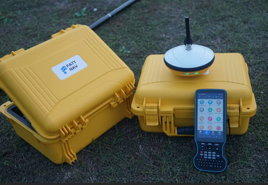
- Collect field data. Use surveying instruments such as total stations, GNSS receivers, and levels to measure distances, angles, and elevations. All observations and readings are meticulously recorded in field books or electronic data collectors, including sketches and descriptions of features.
- Identify existing infrastructure. Locate any existing utilities (power cables, drainage systems) or structures that might affect the project.
- Mark boundaries (if applicable). Where required by law or the client’s request, permanent markers or pins are placed to delineate the property’s final boundaries on the ground.
Phase 3: Office Work and Deliverables.
- The final stage involves processing the collected data and presenting the findings in usable formats.
- Data processing and analysis. The raw data is imported into specialized software for processing. This involves performing calculations, adjustments, and corrections to transform raw field data into accurate coordinates, elevations, and areas.
- Quality assurance. The results are checked for errors or discrepancies, and adjustments (e.g., using a closed traverse loop adjustment method) are made to ensure accuracy and adherence to required tolerances.
- Map making and reporting. Create accurate maps, plans, and reports that communicate the findings. These deliverables may include:
- Boundary and topographic maps (plats).
- Site plans, layouts, and 3D models.
- A detailed survey report of site conditions.
- New deeds or legal descriptions (if required).
- Documentation and recording. The final drawing or plan is produced, signed, sealed by a licensed surveyor, and recorded in the appropriate government office for public record.
- Client handover. The final deliverables are provided to the client, engineers, architects, and contractors for use in planning, design, and construction.
Common Mistakes in Land Surveying
Incorrect calibration of equipment. Survey instruments must be properly calibrated to ensure accurate measurements. Regular calibration ensures optimal accuracy and compliance with ISO and other applicable standards. Skipping this step can lead to major measurement errors that throw entire projects off course.
Ignoring environmental factors. Weather conditions and terrain can significantly impact survey accuracy. Factors such as temperature fluctuations, wind, and atmospheric pressure can distort measurements. Wherever possible, it is recommended to plan surveys around stable weather conditions.
Poor control point selection. Choosing weak or unreliable control points can compromise the accuracy of your survey. This can lead to incorrect positioning of structures and misalignment issues. It is recommended to select stable and well distributed control points.
Failure to account for human error. Even with the best equipment, human error remains a leading case of survey mistakes. Misreading measurements, inputting incorrect data or failing to double-check results can all contribute to costly issues. It is advisable to always double check measurements and data entries. Use automated data collection systems where possible. These reduce human errors by automating key processes such as data collection, coordinate calculations, and real-time positioning, improving the overall efficiency and ensuring greater accuracy by minimizing manual input errors. Use of advanced surveying equipment integrated with data logging and processing software further enhances precision, allowing surveyors to validate measurements instantly and detect discrepancies before they become major issues.
Using outdated or inappropriate equipment. Outdated or unsuitable equipment leads to inaccurate readings and costly project risks. Modern tools improve efficiency, accuracy, and ease of use; key to a successful survey. An extensive fleet of the latest survey equipment could include equipment such as total stations, GNSS systems, 3D laser scanners and UAV (drone) surveying solutions. All these equipment are designed to provide superior accuracy, efficiency, and ease of use; leading to optimal results.
Inadequate or inaccurate field data collection. Data collection as the foundation of surveying projects. As such, accurate data and results are critical. The accuracy of data collection directly impacts the quality of your project outcomes. Incorrect measurements, missing data points, and poor documentation could potentially lead to significant rework or even legal issues.
Failure to follow legal requirements. Surveying isn’t just about measurements and maps; it’s also about adhering to legal standards. For example, some areas require specific permits for certain types of surveys. Another mistake is neglecting to update records with local authorities, which can lead to discrepancies and legal challenges. Neglecting and failing to meet these legal requirements for surveys can result in penalties, project delays, or even legal action.
Neglecting safety protocols. Surveying often involves working in dynamic, potentially hazardous environments such as busy roadsides, dense forests, or active construction zones. When conducting surveys on-site, safety should be paramount. Wear appropriate personal protective equipment (PPE) like helmets, gloves, and high-visibility clothing to ensure safe operations.
Relying solely on technology. While technology can enhance the accuracy of your results, do not rely on it completely. Instrumental errors, GPS signal loss, and software glitches are eventualities every surveyor must prepare for. Trust your professional judgement, and when necessary, resort to traditional surveying methods to confirm digital findings.
Neglecting equipment maintenance. Survey equipment requires regular maintenance to function correctly and provide accurate data. Neglecting equipment upkeep could lead to inaccuracies or delays. Regularly check your gear for damages or calibration issues and perform routine adjustments as needed.
Skimping on site reconnaissance. Conducting proper site reconnaissance is necessary before starting any survey. This helps you identify potential challenges like access issues or terrain difficulties. Without preliminary surveying, you might overlook critical factors, leading to incomplete or inaccurate data.
Skipping data backup. Always back up your survey data. Technological failures, data corruption, or accidental deletions can occur, and without a backup plan, you risk losing essential information. Implementing a routine schedule for data storage and backup ensures the safety and security of your collected data.
Disregarding instructions from clients or supervisors. Every project comes with specific instructions and expectations from stakeholders. Disregarding these can lead to a misalignment in project outcomes. Ensure you fully understand the project requirements before commencing your survey, and consult your supervisors or clients to clarify any ambiguities.
Surveying Tools and Equipment.
Owing to rapid advancements in technology, surveying tools have evolved and do encompass traditional tools and advanced modern high-tech equipment. The different core equipment, key accessories, and support gear include.
- Single beam sonars.
- Multi beam sonars.
- Single beam echosounders.
- Multi beam echosounders.
- GNSS receivers (global navigation satellite systems).
- GNSS rovers.
- RTK systems (real-time kinematic).
- Dumpy levels.
- Robotic total stations.
- Theodolites and EDMs (electronic distance meters).
- GPS devices.
- Sub-bottom profilers.
- ADCPs (acoustic doppler current profilers).
- GPRs (ground penetrating radars).
- LiDAR scanner drones (light detection and ranging).
- Measuring wheels.
- Surveying chains.
- Prismatic compasses.
- Prism poles.
- Plumb lasers.
- Plumb bobs.
- Offset rods.
- Levelling staff.
- Surveyor’s compass.
- Measuring tapes.
- Pipe and cable locators.
- EMLs (electromagnetic locators).
- 3D laser scanners.
- Borehole dip meters (water level meters).
- Digital levels.
- Optical levels.
- Laser distance meters.
Factors Influencing Cost of Land Surveys
The cost of undertaking a land survey varies greatly, depending on several factors such as.
Terrain and accessibility. Challenging landscapes such as dense forests or steep hills may require additional equipment and time, increasing costs. Properties in remote areas might also involve extra travel expenses.
Complexity of boundaries. Properties with unusual shapes, multiple boundary lines, or complex legal histories require more research and fieldwork, which can raise costs.
Quality of records. If records are incomplete or conflicting, surveyors may need additional time for research and reconciliation, leading to higher fees.
Local regulations and standards. Local rules on survey standards or required markings add to the overall cost of the survey.
Size of the site. Depending on the area/acreage of the site under consideration, costs will vary from one site to another. Larger sites require more time and resources to survey comprehensively, thus higher costs.
Level of detail required. Some projects need every minor feature recorded, whilst others require only major elements, and this directly influences the costs accordingly.
Deliverable formats. The deliverable formats preferred by the client do dictate the overall price tag. Basic 2D drawings are less expensive than detailed 3D models or BIM integration.
Conclusion.
Accurate surveying is the foundation and backbone of successful projects in civil engineering, land development, and mining. All the different forms of surveys, ranging from cadastral surveys, boundary opening surveys, land subdivision surveys, topographical surveys, utility mapping surveys, hydrological surveys, geological surveys, and hydrogeological surveys need to be executed to utmost industry standards with virtually no margin of error. At SANKOFA, we undertake meticulous planning to offer high quality surveying outputs, delivering impeccable results with industry grade accuracy. As a trusted and leading land surveying company in Uganda, we provide expert surveying solutions tailored to your specific project needs ranging from individual projects to large-scale commercial land developments and construction projects.
